Recently on the Web and Social Media: The Hevelin Fanzine Digitization Project was featured on The Verge. The University of Iowa Libraries is digitizing science fiction fanzines from the 1930s-1950s. August Old Gold column from University Archivist David McCartney, Harrison Hall, the Residence Hall That Never Was. The planned 1,100-student high-rise,Continue reading “Special Collections Week in Review, 8/28 – 9/4, 2015”
Tag Archives: map
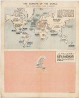
World War II Map of Occupied Countries
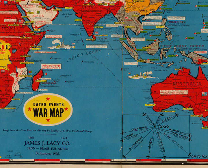
Today is Veterans Day so we want to share this 1943 map of occupied countries, noted in gray. The legend reads: “Help erase the gray blots on this map by buying U. S. war bonds and stamps.” This map is part of the John N. Calhoun Papers. Calhoun lived in Burlington, Iowa. After earning his lawContinue reading “World War II Map of Occupied Countries”