Dr. Blalock had asked us to look at series of interviews on the Los Angeles Review of Books’ website, collected by Melissa Dinsman, “The Digital in the Humanities: A Special Interview Series.” I read the interview with Dr. Jessica Marie Johnson. Dr. Johnson makes a statement early in the interview regarding her idea of the best “field[s] of inquiry” that deserve more attention by humanists, her response was telling, “I think the humanities has a justice imperative that it has not quite fulfilled as a mission (even as individuals continue to work and push that).” This got me to thinking about what it was that my project might have to do with a “justice imperative”?1
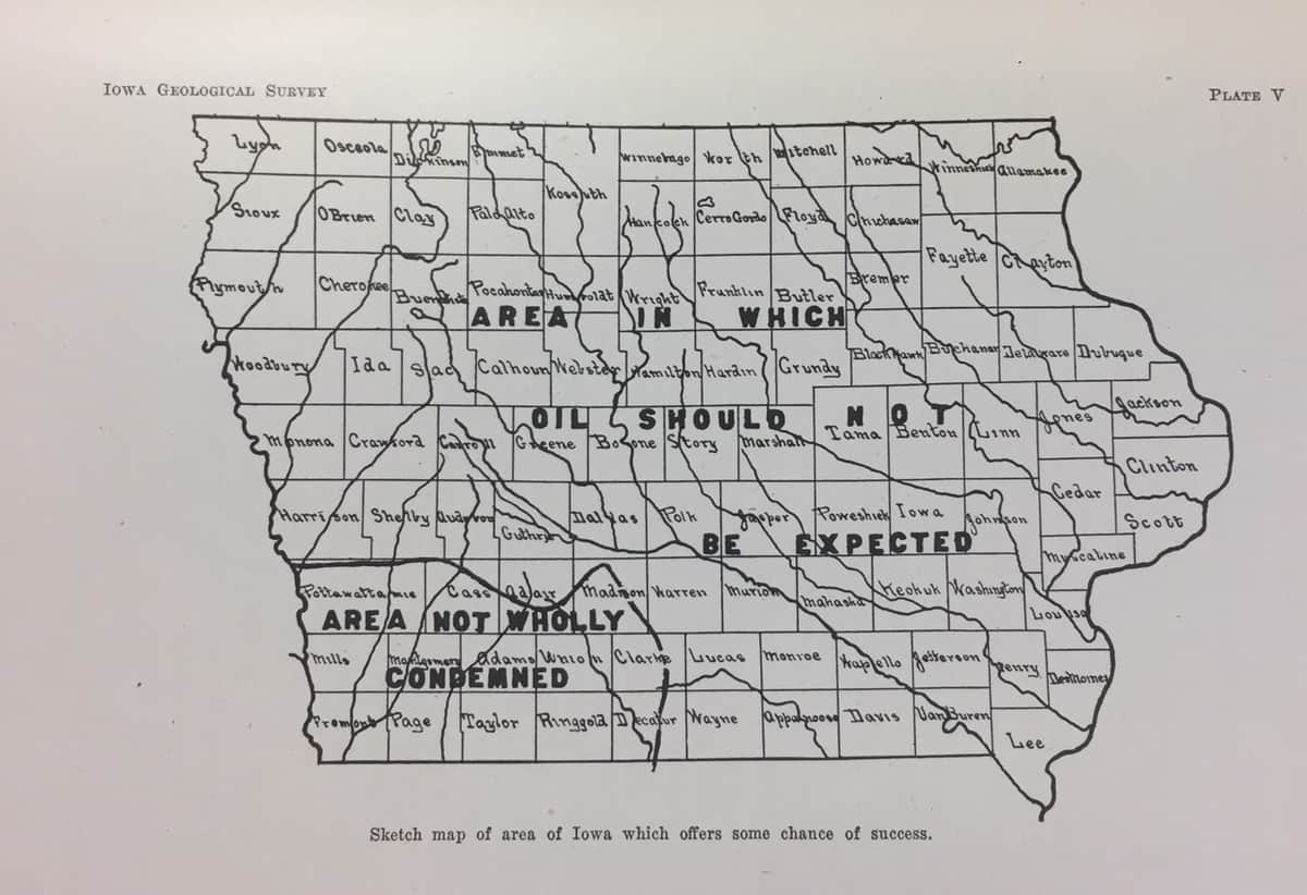
Figure 1 “Sketch map of area of Iowa which offers some chance of success.” From: Howell, Jesse V., “Petroleum & Natural Gas in Iowa,” Iowa Geological Survey Annual Reports, 1919-1920.
As I started working with Dr. Rob Shepard on mapping oil and gas development in the United States, it became clear that the state of Iowa would provide a good opportunity to test some ideas I had about the potential for digital work to aid historical research. After importing a series of USGS shapefiles and creating a shapefile for the state of Iowa in esri’s ArcGIS program, we were able to see a rough approximation of oil and gas exploration in Iowa from the nineteenth century up until 2005. I’ve included a photo of a poor approximation. Using this data I found that over 50 of Iowa’s counties have had wells drilled in them.
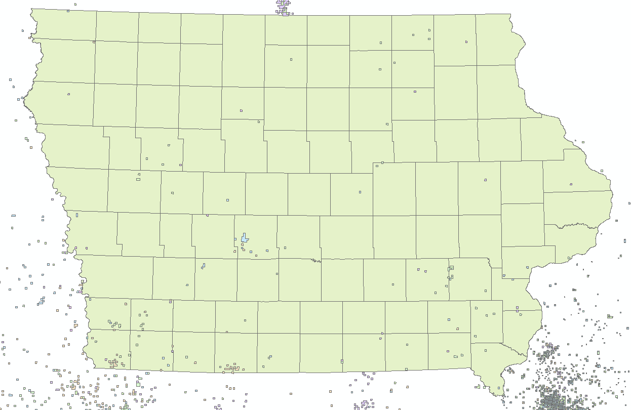
Figure 2 My garbage map, made with esri’s ArcGIS software. From USGS.gov, https://certmapper.cr.usgs.gov/data/noga00/natl/spatial/geodatabase/uscells06gg.zip
The data from the map allowed me to begin cross-referencing these data points with records from the Iowa Geological Survey. Already I am seeing that there is some discrepancy between the two. For instance, the image below shows oil development from the 1940’s to the 1960’s, where the well’s drilled in the 1940’s are peach, the 1950’s blue, and 1960’s green. Since there were no wells drilled in the 1950’s no blue squares are present. However, on the IGS website I was not able to corroborate all of the data points that the USGS has in its data. For a total 20 data points in the USGS data for Fremont County, Iowa, in total, there were only 11 records for oil and gas wells drilled in Fremont County on the IGS’s web-based data portal. And for the 1940’s, a decade that the USGS data shows at least 15 data points, the IGS has only 6 records.
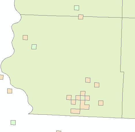
Figure 3 Oil and Gas Wells Drilled in Fremont County, Iowa between Jan 1, 1940 and Dec 31, 1969. The well’s drilled in the 1940s are peach, the 1950s blue, and 1960s green. From USGS.gov, https://certmapper.cr.usgs.gov/data/noga00/natl/spatial/geodatabase/uscells06gg.zip
What does all this have to do with justice? Every data point in the USGS info pegged to a quarter-mile square that allows you to locate the approximate location of the well within a given section of a county. The IGS data includes township, range, and section data that allow you to see exactly where the wells were located geographically. I haven’t gotten as far as mapping the second set data points yet, but what I already see is a disconnect between publicly available government data on the state and federal level. What troubles me is that more development in the Forrest City Basin area (most recently by the Houston-based Chocolate Flats Petroleum) in which Fremont County sits, is going to continue to get little local attention. In addition, these publicly available data are not being usefully synthesized in a way that makes them understandable to non-experts. My hope is that by continuing this work I will be able to better document and account for these gaps in the data, doing a service to the state of Iowa.
- Dinsman, Melissa (2016). “The Digital in the Humanities: A Special Interview Series” (Links to an external site.) Links to an external site,” Los Angeles Review of Books.
I’d like to know what anyone thinks.
Thanks,
-John Jepsen
john-jepsen@uiowa.edu