To begin, I would like to thank the Graduate College and the University of Iowa Libraries Digital Scholarship & Publishing Studio for the opportunity to work on my digital project over this summer.
To recap, I intended to build an interactive map of nuclear waste transportation routes from operational and retired nuclear reactors to Yucca Mountain, Nevada. Essentially, I wanted to rebuild the 1995 nuclear waste transportation route map in ArcGIS and make it interactive.
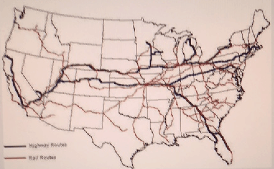

To recreate the above 1995 map on the left from the US Census Bureau Tiger shapeline file for the nation’s railways on the right, one has to select each pathway individually and add it to the map on its own layer.
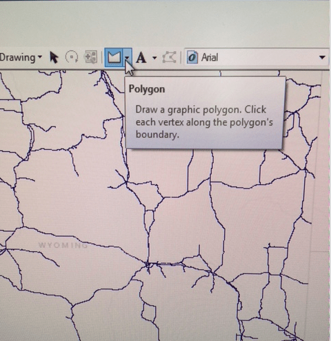
There are a few ways one can do this in ArcGIS. The first, is to use the select tool from the drawing menu and select an individual route. As most of the Tiger file rail routes were drawn as individual polylines of short duration, I found this to work better for editing individual routes rather than building a map from them.
My preferred way of selecting rail routes was by using the polygon tool (also within the drawing menu):
After highlighting the route to be taken, chose Select by Graphics:
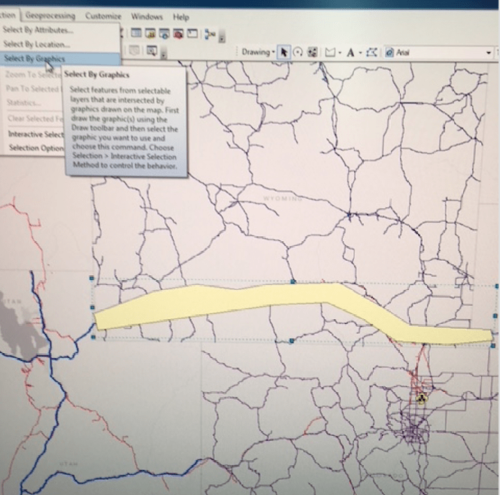
Which will give you the following results:
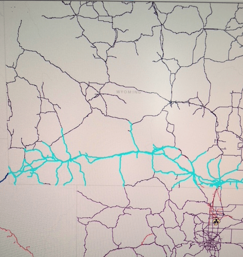
This method, however, adds in a certain messiness that will have to be cleaned up in the editing stage.
My first iteration resulted in:

On the surface, this isn’t a far cry from the original 1995, but there still is a significant amount of work to be done.
During the editing phase I realized that while the Tiger rail shapefile was drawn in short, almost unmanageable polylines, the national highway grid wasn’t. This made cleaning up a bit easier.
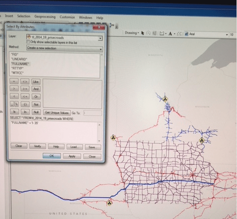
Upon my second iteration, I deleted my existing highway selections from the map and used the Select by Attributes feature. To find the attributes of any giving segment click the Identity button from the main menu: 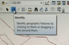
And your cursor will change to:
![]()
With a little “i” above it. From here you can pull up the Attributes table and select by your preferred attribute, in this case the I-35.
Under the first method, my original IA highway grid looked like:

Under the second, however, it looked like:
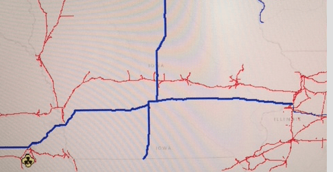
Much cleaner and easier to work with. In the first mapping I would have to edit out all of the unintended selections while in the second, I still have to edit part of the I-35 that extends south of the I-80.
I finished my second iteration by the end of the third week and once again started on my edits. And like all great epics, this is where the story begins, in the midst of things.
If you recall from my earlier post, I was unaware that ArcGIS did not run on Macs, so I had to reschedule time to edit throughout the lab, which created scheduling conflicts for me outside of the labs operating hours. I resolved this by having the university’s ArcGIS program downloaded on my office computer. The only problem here was that the University’s license was for ArcGIS 10.4 and the Studio was already operating on 10.6. All of my existing work would not run in 10.4. Fortunately there is work-a-round where you can save ArcMap files under an earlier version. Problem one solved. Now for problem two.
There’s an issue with ArcGIS’ licensing where the program doesn’t respond for up to 2o+ seconds under borrowed licenses. This makes editing unmanageable. For each selection count twenty seconds. For each deletion, twenty more. Then add time if you are extending a road or route. Triple it if the deletion you just made bifurcated the route in two and now you need two more edits. It only gets more complicated from here. It took twelve hours of lab time to clean up California. Granted not every state is as complicated as CA, but some are two to three times more detailed.
There is a work-a-round for this too that we have yet to try. Per message boards and forums, downloading a local license manager should alleviate the problem. This will have to wait for the second iteration of this project, however.
This fellowship taught me to be a better problem solver and project manager, two critical skills necessary to undertake any future project.
Best,
Greg Rozsa